
Golden Valley Street Directory Method
Address work in Golden Valley starts by resolving the place before drawing a conclusion about a person. The county parcel system can display a taxpayer or owner field, a mailing address, a situs address, a PID, a legal description, taxes, assessments, and sales. Those fields serve different purposes. A mailing line may belong to an owner, taxpayer, or agent, while the situs line identifies the parcel location. The county notes that its public property database is updated on business nights, but the recent recording history is only a limited convenience feature. Use the street directory trail as a series of dated record checks rather than a current household list.
- Enter the full address in Hennepin County Property Information Search. Try the documented street abbreviations and direction placement if the first spelling fails.
- Copy the PID and legal description, and record whether the result shows an owner or taxpayer display, a mailing line, and a situs line.
- Use the PID and legal description in the Recorder route. The land index can connect the parcel to deeds, plats, releases, certificates, and other recorded instruments.
- For an individual registration question, use MNVotes only with the person’s full name, date of birth, and exact address already known. It is not a street-wide roll.
- For past address clues, compare dated HCLIB directory pages and nearby years. Record the publication year and page image before treating an entry as an occupancy lead.
Keep the query spelling, source date, and result identifier together. That makes a negative result useful too, especially where a road, plat, or city label has changed.
Golden Valley Address Parcel Search
The assessor application is the first practical stop for a Golden Valley address. Its address mode requires a house number and street name, accepts an optional unit, and lets the reader choose records per page. The street name is not a free-form ZIP or city search. The county recommends at least three street characters and documents common road abbreviations. When a building has units, repeat the search with the unit field rather than assuming one result covers the whole building.
| Hennepin search field | Required or available option | Street research use |
|---|---|---|
| House number | Required numeric address field | Starts a parcel search at one location |
| Street name | Required, with county abbreviation and direction guidance | Tests a documented spelling variant |
| Unit number | Optional in address mode | Separates unit-level results when present |
| 13-digit PID | Required in PID mode; dashes or spaces are accepted | Supplies the stable parcel key after an address hit |
| Addition, lot, block | Addition required; lot and block optional | Helps when a plat or historic street form is stronger than the modern address |
The return fields can include owner or taxpayer display, mailing and situs addresses, PID, legal description, addition or lot and block, tax, assessment, and sales information. The public page does not document an owner-name mode. If the portal is unavailable, provide the PID, address, and legal description to Tax Information and ask which archived series can be inspected or copied.
The county PID search shows the field used after an address result has been reconciled.
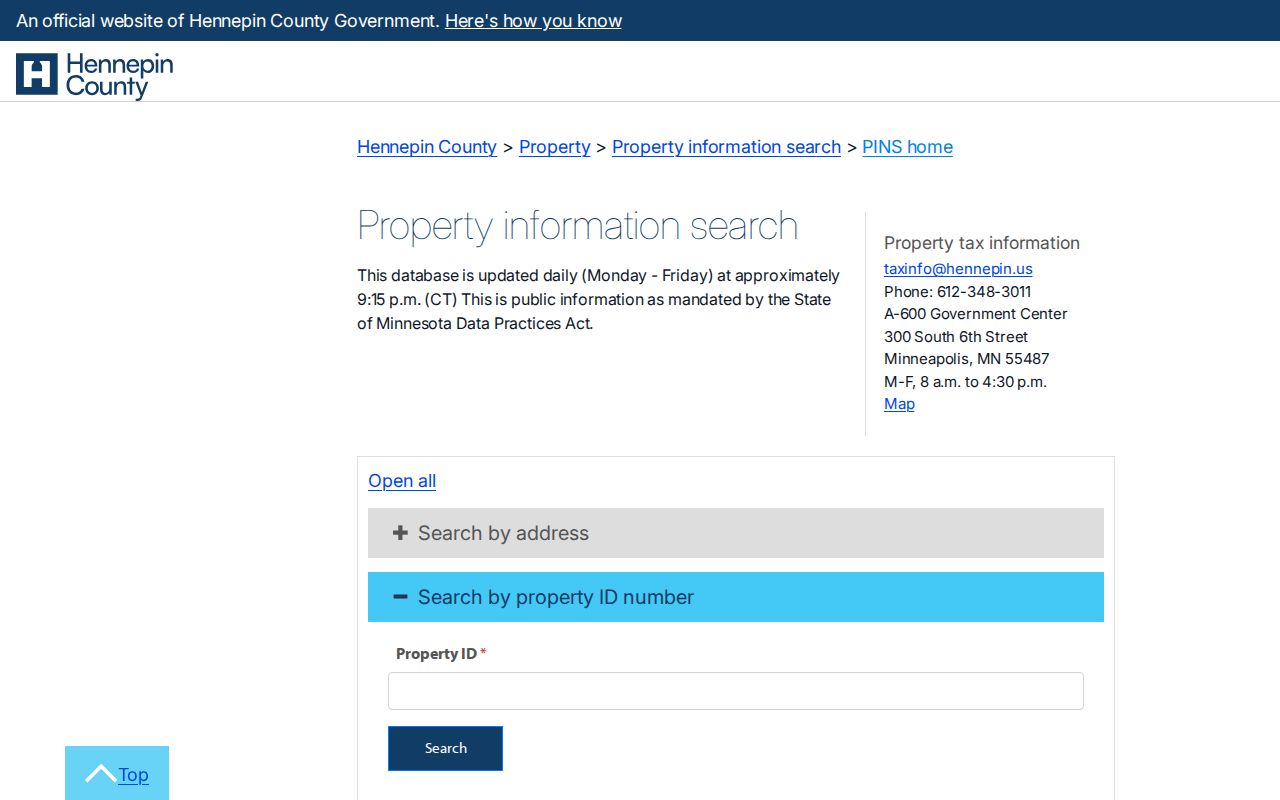
Use the PID as the bridge between a street spelling and the parcel’s legal description; it is more stable than a mailing city label.
Note: A property assessment result is administrative context, not a complete opinion of title or present occupancy.
Golden Valley Streets by Addition
Addition search is valuable when a Golden Valley road has an older form or a parcel has been replatted. Hennepin’s addition mode requires an addition name and accepts optional lot and block values. The county permits abbreviated addition names, gives examples such as Goodwin Addn and Auditor’s Subd. No. 067, and accepts lot or block values with or without leading zeros. Preserve the returned spelling before moving to the Recorder.
The addition search page illustrates the addition, lot, block, and page-size controls used for a plat-based lookup.
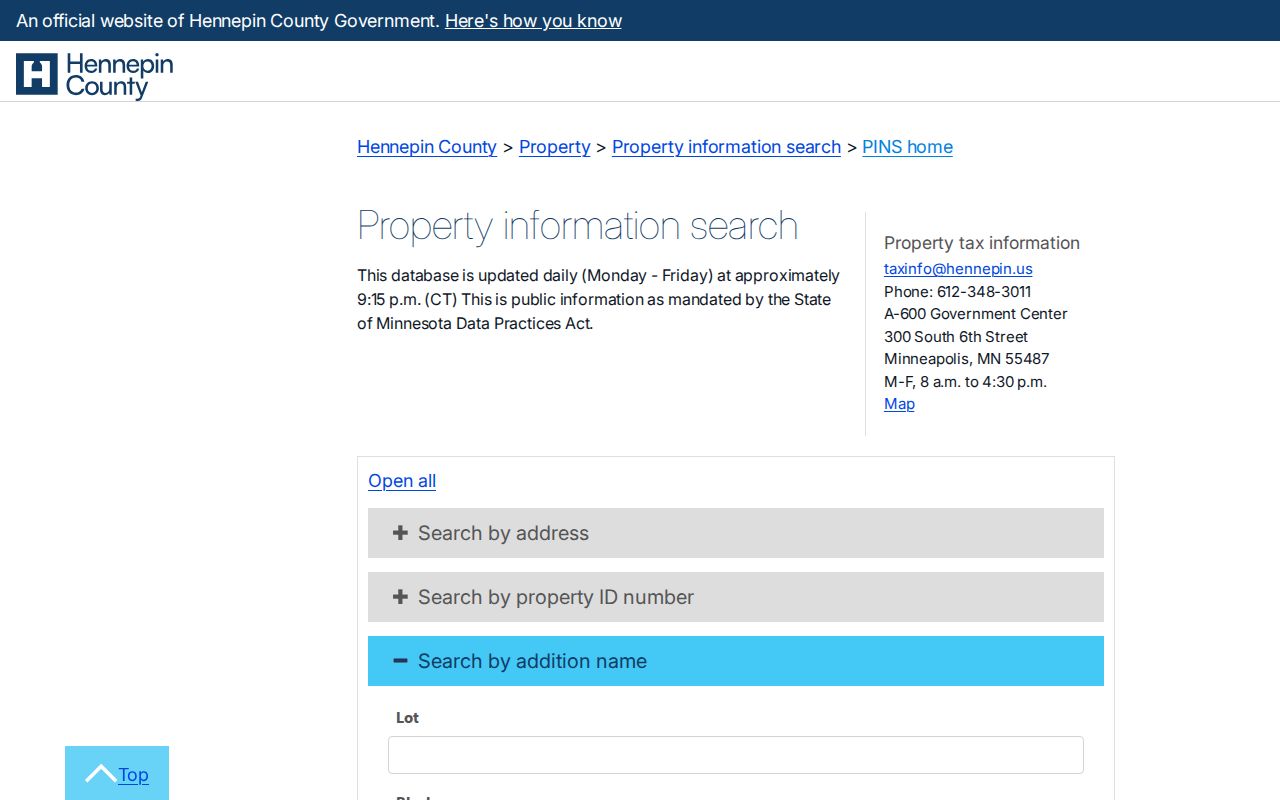
That route can be more useful than a street field when an old record uses a subdivision description or when later plats changed a parcel’s shape.
- Parcel
- A defined piece of land carried in county property records, commonly tied to a PID.
- Situs address
- The location of the parcel, distinct from the address used to receive tax mail.
- Plat
- A recorded map that creates or changes lots, blocks, streets, or subdivisions.
- Criss-cross directory
- A reverse directory arranged by address, used as a dated lead to an occupant or business.
Note: Keep the exact addition spelling and lot-block form with the PID when comparing old and current parcel records.
Golden Valley Street Permit Files
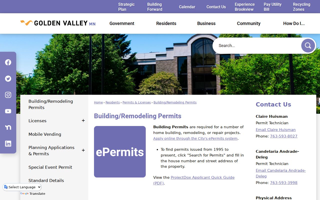
City permit and planning files add a municipal layer that a parcel card cannot provide. The City of Golden Valley says its ePermits search covers permits from 1995 to the present and can be searched by house number and street address. A result is an index, not the whole file. When the underlying details matter, request the application, plans, inspection history, correction notices, and final approval by address, PID, permit number, or date range.
The Golden Valley building permit page directs researchers to the address-based permit search and to Building Inspections for questions.
For an older permit, planning file, I&I certificate, or code record without an open index, make a focused Chapter 13 request through the City Clerk or the named department. State the address, parcel, date range, record type, and inspect-or-copy preference. The city accepts requests through its portal, email, mail, or fax, and it may release public portions after redaction.
Note: Inspection does not carry a copy charge, while eligible copying and preparation costs may apply.
Golden Valley Address Record Coverage
Each address-keyed source answers a different question. The parcel record joins a street location to a PID and legal description. The Recorder ties that description to land instruments. City departments retain permit and planning material, while HCLIB supplies dated directory evidence. A street directory search is strongest when the sources agree on the location and date, not when one result is read in isolation.
| Address record | Local keeper | Useful fields | Access path |
|---|---|---|---|
| Parcel card | Hennepin County | PID, legal description, owner or taxpayer display, mailing and situs lines, tax and sales context | Free address, PID, or addition search; weekday updates |
| Parcel map | Hennepin County | Parcel polygon, roads, adjoining parcels, map context | Free GIS viewer; reference use only |
| Deed and title index | Hennepin Recorder | Transfers, mortgages, liens, releases, plats, and Torrens memorials | RecordEASE, public kiosks, copy routes; recent portal history is five years |
| Building permits | Golden Valley Inspections | Applications, inspections, corrections, plans, and final records | ePermits by address from 1995; older files by request |
| Planning and code files | Golden Valley Planning or Code Enforcement | Zoning, site plans, notices, conditions, and complaint stages | Address or project request under Chapter 13 |
| City directories | HCLIB ResCarta | Dated occupant, business, and address clues | Digitized Golden Valley run for 1951 to 1981 |
| Voter records | Minnesota Secretary of State and elections offices | Eligible public registration and voting-history fields | Individual MNVotes match or restricted lawful bulk request |
For a city-held record, the Golden Valley public-records request portal distinguishes Public Data, Data on an Individual, and Police Data. A general public-data request does not require a reason or identification, but a request involving private data may require identity or authority.
Note: If a custodian withholds material, request the classification citation and ask whether a redacted public portion is available.
Map a Golden Valley Street
The Hennepin property map is a careful way to check a street location, a parcel boundary, and surrounding road context. Search or locate an address, pan and zoom, select the parcel, then compare the resulting PID with the assessor page. The inspected map workflow supports address or parcel context, but the exact live layer list and export options were not confirmed in the research. Do not describe a colored boundary as legally controlling without its legend and the recorded source.
Map context matters near municipal boundaries. Golden Valley mailing lines can use Minneapolis or a nearby city, and roads cross municipal borders. Compare the jurisdiction field, parcel identifier, and legal description instead of relying only on the street name or a mailing-city label.
Golden Valley Street Deed Trail
After the PID and legal description are known, Hennepin’s Recorder or Registrar of Titles is the land-record route. It records deeds, mortgages, assignments, releases, liens, plats, and instruments in abstract and Torrens systems. The county says roughly 45% of its property is Torrens, so a deed-only search may omit a certificate or memorial trail. RecordEASE has a limited public-search path and a paid Pro system; its public kiosks at the Hennepin Government Center offer another research channel.
Work backward from the newest deed or certificate and log the document number, recorded date, instrument type, grantor, grantee, legal description, and page count. The property portal’s five-year recent-history display may help locate a recent instrument, but it is incomplete by design and is not a substitute for the Recorder index. Copy questions can go to the Recorder, and the county also documents electronic, mail, certified, and kiosk research routes.
Golden Valley Street History Clues
Hennepin County Library has digitized Golden Valley city directories covering 1951 through 1981 in a 22-entry ResCarta subset. These volumes are most useful as dated address evidence. Search an address through nearby years, then try the surname and nearby addresses. Record the volume, year, page image, address, resident or business wording, and source URL. An entry can establish that a printed directory associated an address with a name on that publication date, but it does not prove ownership, continuous occupancy, or a present address.
HCLIB also holds yearbooks, maps, clippings, newspapers, photographs, and web archives. For sustained directory work, the historical volumes are described in more detail on the Golden Valley city directories page.
Golden Valley Street Name Variants
Older address work needs a variant list. The city transportation material identifies Watertown Road as the present Golden Valley Road and records the Luce Line in 1912, Highway 12 widening in 1920, Highway 55 construction in 1922, and the Belt Line or Lilac Way work in 1932. Those milestones explain why an old directory, map, or planning file may use a road form that does not match a current search field.
The Golden Valley Historical Society’s street-name research supplies more local terms, including Bassett Creek, Medicine Lake, Lilac, Turner, Varner, Bies, Ewald, Schaper, and Schuller. Use a variant to search a directory, plat, newspaper, or city request, then verify the result with the PID or recorded legal description. No official citywide renumbering event was verified, so a suspected number change should remain a research question until a plat or other source confirms it.
Note: A street-name study generates search variants but does not substitute for an official plat, ordinance, or recorded instrument.
Golden Valley Street Search Limits
An address search does not reveal an unrestricted household roster. MNVotes requires a specific individual’s name, full date of birth, and exact address for its individual tool. A public voter list has statutory purpose limits under Minn. Stat. §201.091, and it cannot be treated as a general street roll. City Neighborhood Watch participant details are nonpublic under Minn. Stat. §13.37. Safe at Home designated addresses, private fields, victim information, and other protected data must not be reverse-engineered or republished.
When records disagree, preserve the difference. A county parcel record is a current administrative source, a recorded instrument controls its legal description, a permit is a municipal-work index, and a directory is a dated publication. A clear source log prevents a mailing address or an old entry from being turned into an unsupported claim.